One man and his drone

One man and his drone

A look at how we are using new technology to help look after our reserves

Drones get a bad press: newspaper stories tend to focus on the zanier uses of them and the genuinely scary tales of people flying near airports. 

Used sensibly, by a licenced operator, drones can be an incredibly useful tool for conservation. They are used by people across the world for mapping reserves, counting nesting birds, and endless other applications.

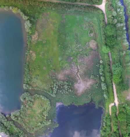
At the Wildlife Trust BCN we have been using drones for the past 2 years to learn more about our reserves and share that information with you. You may have seen videos on the website, or panoramic images like the one of Godmanchester nature reserve, above. This perspective literally gives a birds-eye view of our sites that would be impossible to see on a normal visit.
Filmed by licensed drone pilot Josh Hellon

We are constantly looking at new applications for this technology - the drone is now mainly used for creating maps of our sites that can then be used to help with management. These maps provide an amazing amount of detail that we haven't had access to before - sometimes making it possible to pick out individual plant species. This info can be used for everything from planning scrub removal to tracking invasive species or assessing heather growth.

From the Godmanchester survey we were able to produce a detailed map of Mouldings Meadow that you can see below. This kind of map will help us target our management in the future.

This kind of work shows that drones aren't all about invasion of privacy and specially trained anti-drone eagles! The possibilities for conservation use are almost limitless. 

Aerial view of mouldings