A four-year wetland restoration scheme in the Nene Valley funded by National Highways, currently in its third year of operation, is delivering successful habitat and infrastructure works to improve reserves for wildlife.
So far, work has restored ponds, lake edges and meadows, implemented artificial sand martin banks and a new cattle bridge along the way. This year will focus predominantly on islands, as well as further lake edges and reedbeds, improving habitat for the overwintering and breeding bird populations that depend upon these sites. Timing is key: the majority of work is taking place August into September, beginning after the bird breeding season but before overwintering birds return. This minimises disturbance to wildlife whilst maximising dry ground conditions required for things to run smoothly.
Much of the work will involve large, noisy diggers, leaving some areas muddy and misshapen – conservation can often be a messy business! Over time these areas will respond positively to the disturbance and wildlife will greatly benefit as a result.
Nene Wetlands
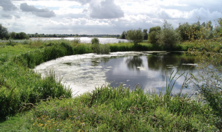
Dragonfly Lake reprofiling Several edges of Dragonfly Lake are steep and vegetated. Overwintering and breeding wetland bird species, for which the Upper Nene Valley holds Special Protection Area (SPA) designation, favour a low-gradient, shallow and muddy water’s edge for feeding, nesting, and breeding opportunities. Roughly two-three metres of land will be scraped from the lake edge, to lower the gradient and expose a muddy edge. The removed material will be pushed into the water to extend the edge, providing wading birds with consistent habitat as the water levels fluctuate between seasons.
An area of grassland with low sward height, extending 200m in total, will be removed. The focal point is the spit south of the target lake edges which will be reduced to match the level of the adjacent island at an ideal height for wading bird populations. Previous work was achieved via the same method on the northern lake edge - this area is now frequently inundated with wading birds using the habitat effectively, in comparison to the planned work areas which currently are not used to the same degree.
Otter Lake island reprofiling On Otter Lake, two islands will be reprofiled. The islands will be lowered to provide a shallow, natural gradient leading and extending into the water’s edge. This will provide a larger surface area of available muddy habitat across the seasons for target species of wading birds, including oystercatcher and redshank.
Scrape reprofiling The scrape at Summer Leys is a purpose-designed wading bird wetland feature, comprised of a deep trench on the western side, with periodically exposed areas of mud, including undulating ridges and mounds. These mounds appear as islands during lowering water levels over the spring, gradually exposing more and more muddy edges for wading birds to feed, nest and breed on.
Annual plants establish across much of the mud throughout spring and summer when these areas of land lie above the water line. Over time, this vegetation covers the muddy patches, hindering habitat quality for wetland bird, and includes the invasive non-native species of New Zealand pigmy weed Crassula helmsii. Additionally, the surface mud gradually attains a layer of silt, as part of the process of winter flooding.
The work is part of a rotational 'refresher' management technique, occurring every five years, using low ground-pressure diggers to scrape back and remove surface vegetation and silt. Across the scrape area (approx three ha), the focus is on three of the exposed islands, as well as the channels meandering between. Reusing surface material, new mounds will be formed at a greater height than present features, allowing earlier emergence during the usual period of falling water levels. This will provide greater habitat availability throughout the seasons, and have a positive impact on the SPA - as seen in previous Wetland Bird Surveys (WeBS), the year following this rotational scrape work sees an influx in the populations of wetland birds, including lapwing, redshank, and oystercatcher.
Additionally, two small causeways will be created within the scrape area to improve access to the islands for small tractors, to help improve future vegetation management, each three metres in width, and at a height which will flood in winter and be exposed in the summer.