Thank you for volunteering for the Ancient Woodland Inventory surveys taking place between the beginning of March and end of April 2024
This webpage contains information on how to complete the surveys. Please read the Ancient Woodland Survey Guidance document first. This explains how to find the woods which need surveying, what features we are asking you to look for and how to identify them.
Survey results should be submitted using either the Word survey form or an online form. There is a separate form for each county.
Ancient Woodland Survey Guidance
Changes since last year’s survey season
For those who undertook surveys for the ancient woodland project last year, there have been a few changes.
-
We would like people to survey woods between the beginning of March and the end of April 2024.
-
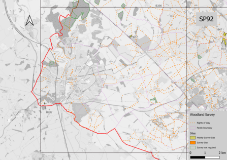
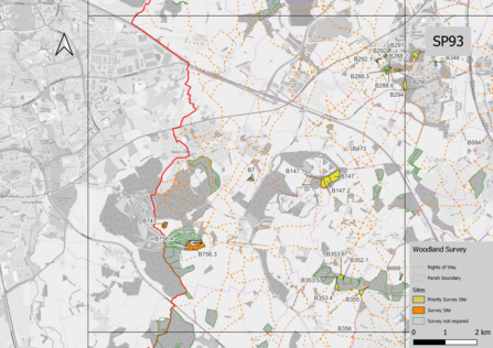
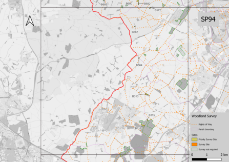
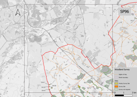
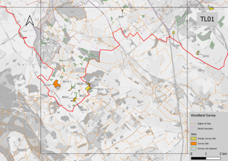
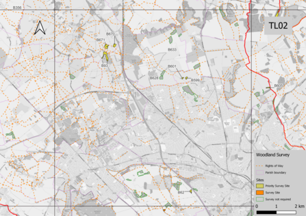
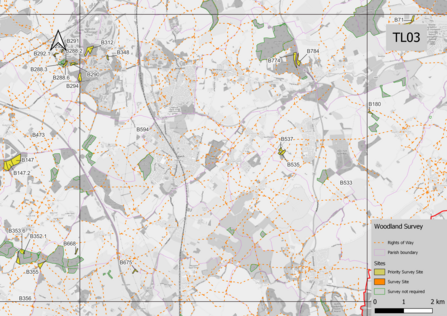
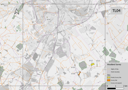
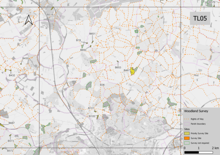
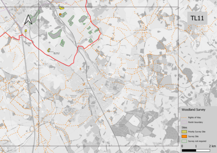
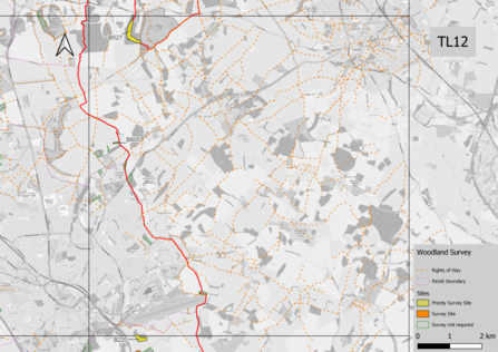
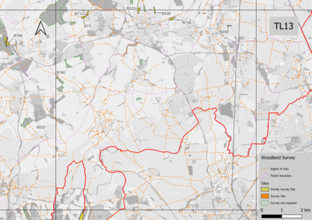
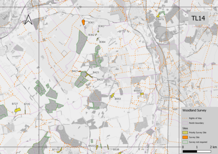
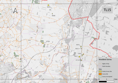
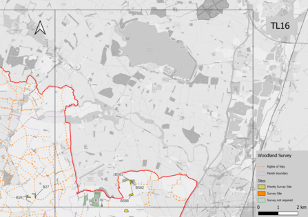
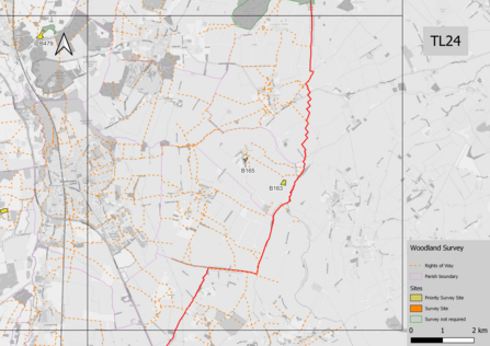
There are fewer sites available for survey. Thanks to the surveys from last year and the additional time spent researching the woodlands there are fewer sites to look at this year. The ones available to survey this year are those with remaining uncertainty about their age or the continuity of woodland. Therefore some 10km squares have no sites which require surveying. These squares are not numbered on the map of the county and the maps are not included in the scrolling images or on Dropbox.
-
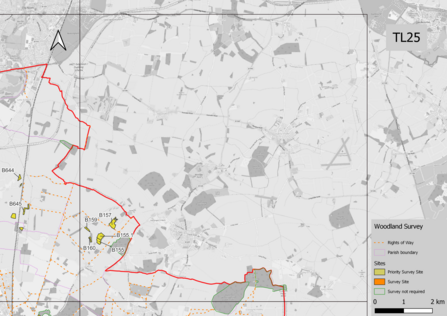
The maps use the same colours as last year. Yellow sites are the highest priority for a survey, then orange sites. Sites with a green outline do not require a survey but are included on the maps in outline to help you locate any joining yellow or orange sites. The sites in green do not have an ID number as they do not require a survey.
-
Some of the areas have been split into multiple smaller areas or only have small sections of a larger wood which require surveying. Where these are too small to see clearly on the maps, or if you are struggling to work out the location, do get in touch as I may be able to provide more zoomed-in maps of the location you plan to survey.
-
On the Woodlands for Survey spreadsheet, you will see that there is a new column named ‘Questions’. These are specific questions for this site and can be answered in Question 29 of the survey form.
-
This year in addition to woodlands you will have the option to survey wood pasture. These are found on the same maps as the woodland and can be completed in the same way using the same survey form as the woodlands. Additional guidance on wood pasture habitats can be found in Appendix 1.
-
Caution - ash dieback. Ash dieback is now well established in many woods and diseased ash trees are more likely to fall and/or drop branches. So as always, please don’t survey in windy conditions, but also just be aware on any survey that ash trees can be a particular hazard and avoid stopping/standing underneath them.
How to carry out a survey
- Identify the part of the county you are interested in on the Key to woodlands map. Note the corresponding 10km square (TL06 for instance)
-
Locate the map for the selected 10km square by scrolling through the list of maps below the key. For some areas there are more detailed maps to help separate woodlands
-
Click on the maps to enlarge them or view a higher quality map using the Dropbox link below the map gallery.
-
On the map each wood is labelled with a Unique Identification Number (UID). Some larger woods are divided into parts each with a separate UID. Note: they are small, so look carefully!
-
Select a wood to survey. Woods are coloured to indicate their survey priority (see below). Only survey sites if they are open to the public or are crossed by a public right of way or are visible from a road or other public right of way or you have permission from the landowner/manager to visit. Designated public rights of way are indicated on the maps.
-
Prioritise sites as follows:
i. Priority survey site (yellow)
ii. Survey site (orange)
Sites outlined in green do not require a survey. They are included for reference as woodlands which we are looking into. These include sites which are ancient woodland but also sites which may not be, but have sufficient survey information from last year.


Higher quality maps can be found here. We recommend only downloading the 10km square maps that you intend to visit.
Find the woodland on the ‘Woodlands for Survey’ spreadsheet
Bedfordshire Woodlands Survey Spreadsheet
-
Use the UID to find the woodland on the spreadsheet. This will give you its name (if known), location information, including parish, Ordnance Survey Grid Reference and What3Words and any specific questions about the site.
-
Make a note of the site’s UID, grid reference and parish – you will need these later to complete the record form.
-
Use any one of the following to find the wood on a map:
- To confirm the location on a paper map using the OS grid reference: A beginners guide to finding grid references | OS GetOutside (ordnancesurvey.co.uk)
- To confirm the location on a phone or laptop enter the grid reference or What3Words into Grid Reference Finder: Grid Reference Finder
-
To confirm the location on your phone with What3Words download the App: Download the free what3words app | what3words
Completing the Survey
Before visiting a wood please read through the survey form to familiarise yourself with the features you are being asked to look out for.
Completed surveys should be submitted using the online form or the downloadable survey form.
Bedfordshire Woodland Survey Online Form
Bedfordshire Woodland Downloadable Survey Form
Please note there are different forms for each county. Forms for other counties are available on the appropriate county maps webpage (links below).
See updates on surveys and example survey progress here:
Ancient woodland inventory survey updates
Survey links for other counties